Tropical Forecasting (North Atlantic)
|
|
The National Hurricane (NHC)'s Tropical Analysis Forecasting Branch (TAFB) produces tropical synoptic analyses for the North Atlantic, East Pacific, and Central Pacific. These are available at https://www.nhc.noaa.gov/marine/
The Atlantic Tropical Weather Discussion is another vital resource for understanding tropical weather and climate.
The Atlantic Tropical Weather Discussion is another vital resource for understanding tropical weather and climate.
Northern Hemisphere Surface Analysis
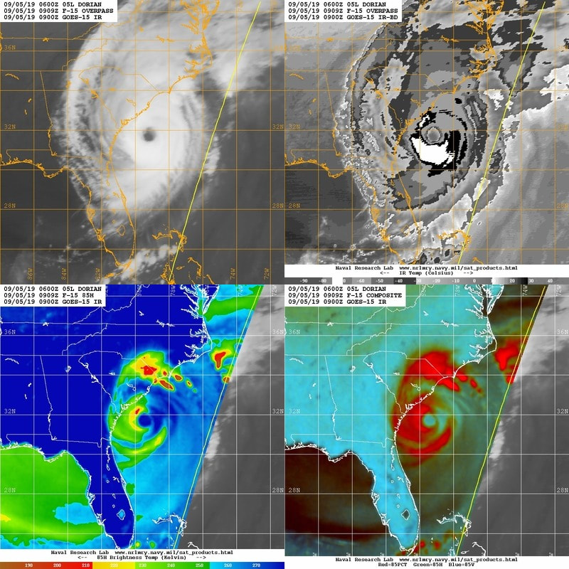
Atlantic and Caribbean Tropical Satellite Imagery
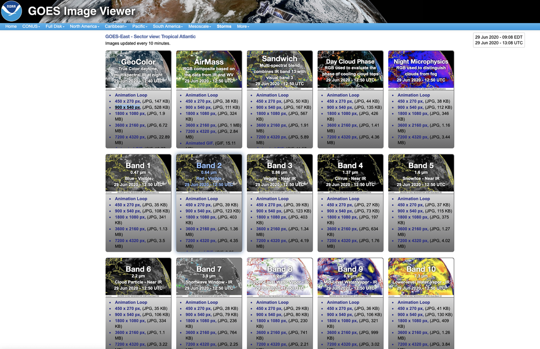
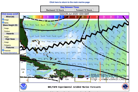
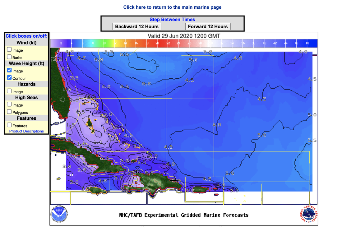
GOES East Tropical Atlantic Imagery
Current Systems
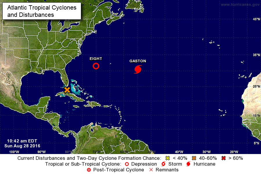
National Hurricane Center
|
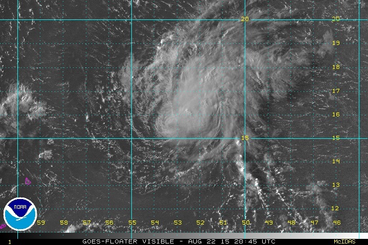
Floater
|
CIMSS TC
NCAR RAL Real-Time Guidance
Satellite & Observational Data
|
|
Model Guidance for Track, Intensity, and Structure
|
Ensemble Forecasting Products
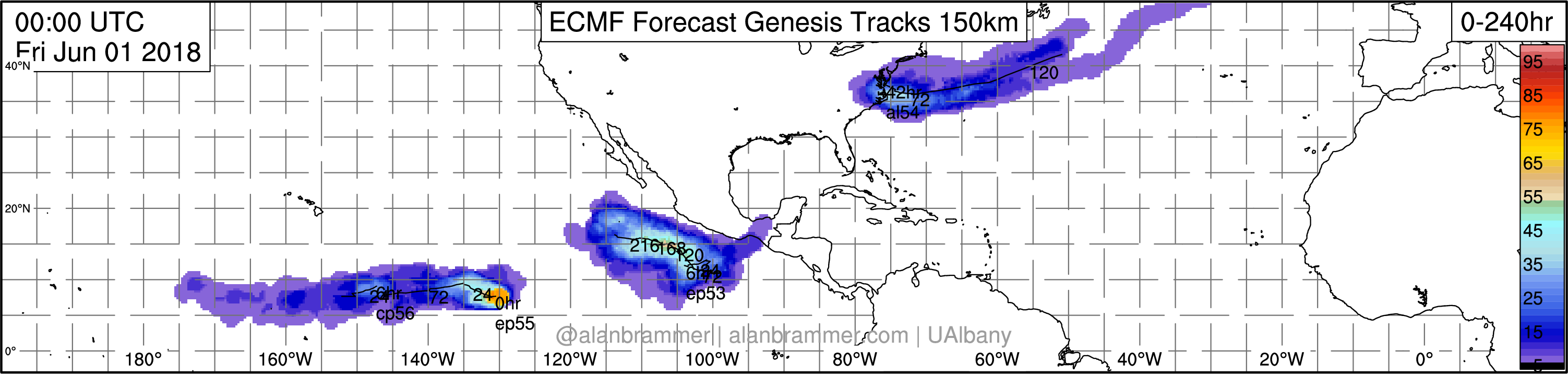
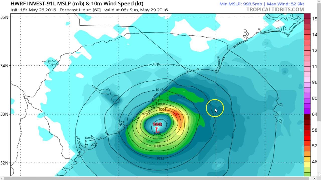
Alan Brammer's Real Time Model Forecast Products
- Brian Tang's TC Guidance & Verification Stats (SUNY Albany)
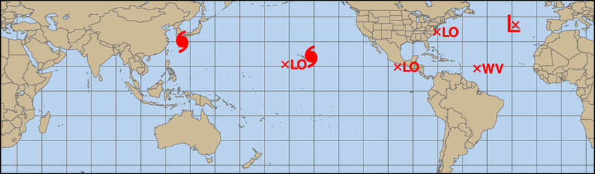
- Alan Brammer's Experimental Tracks and Genesis Probabilities (SUNY Albany, image above shows genesis probabilities from June 2018)
- NOAA HFIP Experimental Tropical Cyclone Storm Tracks from Experimental Model and Probabilistic Model Forecast Products
- NOAA TC Genesis Forecasting Probabilities
- NCEP/EMC Cyclogenesis Tracking
- FSU TC Genesis Products
- FSU Experimental Model-Indicated Genesis Potential
- ECMWF Ensemble Mean and Spread
Precipitation
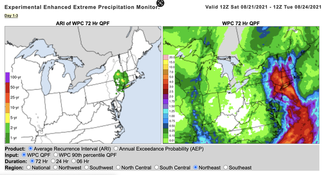
National Weather Service (NWS) Weather Prediction Center (WPC) Forecast for Hurricane Henri (2021) Valid 12Z Sat 08/21/2021 - 12Z Tue 08/24/2021: LEFT: Average Recurence Interval, RIGHT: Day 1-3 Quantitative Precipitation Forecast (WPF)
- NWS Weather Prediction Center (WPC) Tropical Forecasting Products
- NWS WPC QPF graphics
- NWS WPC Forecasters Toolbox
- NWS National Blend of Models Experimental Quick-Look Images (Plot 'QPF24 50' and 'QPF24 90' to visualize most likely and worst case scenarios)
- NWS WPC Experimental Enhanced Extreme Precipitation Monitor displays most likely (50%) and worst case scenario (90%) forecasts alongside recurrence intervals (example in image above) - DISCONTINUED?
- GEFS Plumes (select QPF and station of interest, Note: will be removed 10/1/21)
- CIMSS SSMI/SSMIS/AMSR2-derived Total Precipitable Water
- Ensemble Tropical Rainfall Potential (eTRaP)
- David Roth's WPC Tropical Cyclone Rainfall Website
- CLImatology-based Quantitative Rainfall (CLIQR)
- International Radar Matrix (old UF website - I need to update)
Other Products
- CSU CIRA Statistical Hurricane Intensity Prediction Scheme (SHIPS) (archive)
- NOAA's Historical Hurricane Tracks
- Brian McNoldy's archived TC Radar Loops
- Florida Climate Center Multi-Precipitation Estimates (MPE) Map
- NC State Institute for Climate Studies (NCICS) tropical monitoring site for tracking the MJO and other equatorial waves
